If you’ve been living in Bengaluru for even a year, you’ve probably heard someone rave about a hidden reservoir near Ramanagara with water so clear it looks almost unreal. That’s Manchanabele Dam — and it’s exactly the kind of place that photographs beautifully on Instagram but needs a proper reality check before you actually go. This isn’t a manicured tourist park with lifeguards and safety railings. It’s a working irrigation dam that happens to sit in one of the most scenic corners near Bengaluru, and understanding both its beauty and its risks matters just as much as knowing the route to get there.
Here’s a complete, honest guide before you plan your trip.

Quick Overview
| Detail | Information |
| River | Arkavathi River |
| Location | Manchanabele village, Ramanagara district, Karnataka |
| Distance from Bengaluru | Around 35–40 km via Magadi Road |
| Distance from Magadi Town | About 19 km |
| Nearest Railway Station | Kengeri, roughly 25 km away |
| Nearest Airport | Kempegowda International Airport, about 65–75 km away |
| Built | 1980s, primarily for irrigation |
| Primary Purpose | Irrigation and drinking water supply to Magadi and nearby villages |
| Visiting Hours | Generally 6:00 AM to 6:00 PM (some sources cite 5:30 PM closing) |
| Entry Fee | Free |
| Critical Safety Note | Over 200 drowning deaths reported between 2006 and 2011; swimming strictly discouraged |
| Best Time to Visit | October to March |
| Popular Activities | Trekking, cycling, birdwatching, guided kayaking, photography |
Where Manchanabele Dam Is Located
Manchanabele Dam sits in Manchanabele village, part of Magadi taluka in Ramanagara district, roughly 35 to 40 kilometres west of Bengaluru. Most visitors reach it via Magadi Road, passing through Kengeri and Dabbaguli village before arriving at the dam site, a drive that typically takes about an hour to ninety minutes depending on traffic.
If you’re coming from Mysore Road instead, you can route through Ramanagara town and connect via local roads, which adds a scenic detour past the district famously known for its rocky hills and its connection to the classic Bollywood film Sholay.
The River Behind This Reservoir
The dam is built across the Arkavathi River, a tributary that plays a meaningful role in the water systems feeding parts of Bangalore Rural district. Its primary function has always been irrigation, supplying water to farmlands around Magadi and supporting the agrarian economy of the region, along with providing drinking water access to Magadi town and surrounding villages.
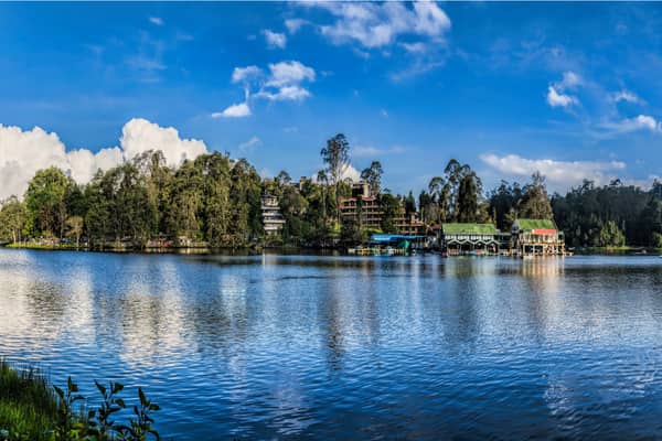
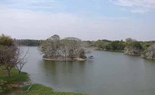
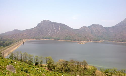
What makes the reservoir visually distinctive is its setting — a natural bowl formed by small, densely forested hills and rocky outcrops typical of the Ramanagara landscape, creating still, reflective waters that have become genuinely popular among photographers.
A Brief History of the Dam
Manchanabele Dam was constructed in the 1980s with a straightforward, functional purpose — supporting irrigation in a drought-prone rural belt west of Bengaluru. Unlike dams with centuries of history or grand freedom-struggle-era narratives, this one has a relatively recent and practical origin story.
What’s interesting is how its identity has shifted over the decades. What started as a purely agricultural water management project has, especially over the last ten to fifteen years, transformed into one of Bengaluru’s most talked-about weekend escapes, driven almost entirely by word-of-mouth and social media rather than any formal tourism development.
Why This Place Needs a Serious Safety Conversation?
This is genuinely the most important section of this guide, and it deserves more than a passing mention. The Manchanabele reservoir bed is known to be treacherous, with sudden fault-lines, large submerged boulders, and unpredictable pockets of deep slush hidden beneath calm-looking water. Between 2006 and 2011 alone, more than 200 people reportedly lost their lives here, many of them confident swimmers who underestimated how quickly conditions can turn dangerous.
Because of this history, access to the dam and reservoir has become inconsistent in recent years. Some current visitor reports suggest that direct entry to the dam structure itself is now restricted or entirely closed off to the public, with authorities cordoning off certain sections following past incidents. Given how much this varies depending on when you check and who you ask, it’s genuinely worth confirming current access rules locally, either through a Bengaluru-based tour operator or by checking recent traveller reviews, before building your entire trip around this specific stop.
If swimming or water activities are part of your plan, the safest route is sticking exclusively to organised kayaking through trained local operators who provide life jackets and proper supervision, rather than attempting to enter the water independently.
What You Can Actually Do Here?
Assuming current access allows it, Manchanabele rewards visitors who come for the surroundings rather than the water itself. Trekking and cycling routes wind through the rocky hills nearby, offering genuinely rewarding views back over the reservoir. Birdwatchers have documented a solid variety of species here, including marsh harriers, kingfishers, purple herons, and little cormorants, making early mornings particularly worthwhile for anyone with a pair of binoculars.
Photography remains the single biggest draw, especially during sunrise and sunset, when the granite hills and calm water create dramatic colour contrasts that have made this spot a favourite among Bengaluru’s weekend photography crowd. Nearby attractions like Savandurga Hill, one of Asia’s largest monolithic hills, and the historic town of Ramanagara add extra depth to a day trip if you’re willing to extend your itinerary slightly.
Timings and Entry Details
Most sources place general visiting hours between 6:00 AM and 6:00 PM, with a few citing an earlier 5:30 PM closing time. There’s no formal entry fee to access the dam surroundings, though adventure activity operators offering kayaking or trekking packages set their own separate pricing.
Given the site’s history of access restrictions, it’s worth treating any listed timing as a general guideline rather than a guarantee, and confirming current status before you commit to a specific visiting slot.
Best Time to Plan Your Visit
October through March remains the ideal window, when the reservoir is at its fullest, the surrounding hills stay lush and green, and daytime temperatures are comfortable enough for trekking or extended photography sessions. Monsoon months, June through September, are generally best avoided given the increased water flow and higher safety risk around the reservoir’s edges.
Frequently Asked Questions
Q1. Is it safe to swim at Manchanabele Dam?
A. No, swimming is strongly discouraged and considered genuinely dangerous due to sudden fault-lines, submerged boulders, and deep slush in the reservoir bed. Over 200 drowning deaths were reported between 2006 and 2011, so even confident swimmers should avoid entering the water independently.
Q2. Is the dam currently open for public entry?
A. Access has varied in recent years, with some reports suggesting certain sections are now restricted or cordoned off following past safety incidents. It’s best to check current status locally or through a recent traveller review before planning your visit around close dam access.
Q3. What’s the best activity to enjoy here if swimming isn’t an option?
A. Trekking, cycling, birdwatching, and photography around the surrounding hills are the safest and most rewarding ways to experience Manchanabele, along with organised kayaking through trained local operators if water activities interest you.
Q4. How much time should I set aside for a Manchanabele Dam trip from Bengaluru?
A. A half-day to full-day trip works well, factoring in the roughly ninety-minute drive each way, along with time for a nearby stop like Savandurga Hill or Ramanagara if you want to extend the outing.