The Narmada River is one of India’s most distinctive rivers. While most major Peninsular rivers such as the Godavari, Krishna and Kaveri flow east towards the Bay of Bengal, the Narmada travels in the opposite direction and empties into the Arabian Sea. Flowing between the Vindhya and Satpura ranges, it creates a remarkable river valley across central India and supports millions of people through irrigation, drinking water, agriculture and hydroelectric power.
The river originates at Narmada Kund in Amarkantak, Madhya Pradesh, and travels approximately 1,312 km before reaching the Gulf of Khambhat in Gujarat. Its main course is primarily associated with Madhya Pradesh, Maharashtra and Gujarat, although Madhya Pradesh contains by far the largest portion of the river’s course.
Beyond geography, the Narmada has exceptional religious and cultural importance. It is considered sacred in Hindu tradition, and places such as Amarkantak, Omkareshwar and Maheshwar attract pilgrims from across India. With spectacular locations such as the Marble Rocks at Bhedaghat and major projects such as the Sardar Sarovar Dam, the Narmada combines natural beauty, cultural heritage and enormous economic importance.

Narmada River Overview
| Particular | Details |
|---|---|
| River Name | Narmada River |
| Other Traditional Name | Rewa |
| Origin | Narmada Kund, Amarkantak |
| Origin State | Madhya Pradesh |
| Approximate Length | 1,312 km |
| General Flow Direction | East to west |
| Main States Along Course | Madhya Pradesh, Maharashtra and Gujarat |
| Major Tributaries | Tawa, Hiran, Barna, Kolar, Shakkar, Dudhi and Orsang |
| Major Mountain Ranges | Vindhya and Satpura |
| Famous Waterfall | Dhuandhar Falls |
| Important Dam | Sardar Sarovar Dam |
| Final Destination | Gulf of Khambhat, Arabian Sea |
| River Mouth | Estuary |
| Special Feature | Major west-flowing Peninsular river |
Where Does the Narmada River Originate?
The Narmada originates at Narmada Kund in Amarkantak, located in the Anuppur district of Madhya Pradesh.
Amarkantak is a highland region where the Vindhya and Satpura geographical systems meet in central India. It is also an important pilgrimage destination.
Narmada Kund is a sacred water tank complex traditionally regarded as the source of the river. From Amarkantak, the Narmada begins travelling westwards through Madhya Pradesh.
The river’s origin is especially interesting because the Son River, which ultimately belongs to the Ganga drainage system, also originates in the broader Amarkantak region but flows in a different direction.
Important facts about the Narmada’s origin:
- Originates at Narmada Kund
- Located at Amarkantak, Madhya Pradesh
- Source district: Anuppur
- Flows predominantly westwards
- Travels through a rift valley
- Ultimately drains into the Arabian Sea
What Is the Length of the Narmada River?
The Narmada River is approximately 1,312 kilometres long.
It is one of the longest rivers entirely associated with India and is among the country’s most important west-flowing rivers.
The river travels from the highlands of eastern Madhya Pradesh across central India before reaching Gujarat and the Arabian Sea.
Unlike many east-flowing Peninsular rivers that form large deltas, the Narmada enters the sea through an estuary.
Its westward journey is strongly influenced by the distinctive geological structure of the Narmada valley.
Which States Does the Narmada River Flow Through?
The main Narmada River is associated with three Indian states:
- Madhya Pradesh
- Maharashtra
- Gujarat
The largest portion of the river flows through Madhya Pradesh.
Madhya Pradesh
The Narmada begins at Amarkantak and flows across a large part of Madhya Pradesh.
Important places located along or near its course include:
- Amarkantak
- Jabalpur
- Narmadapuram
- Omkareshwar
- Maheshwar
Near Jabalpur, the river flows through the spectacular Marble Rocks at Bhedaghat and forms the famous Dhuandhar Falls.
Further west, it passes through several agriculturally and culturally important areas.
Maharashtra
The Narmada does not have a long interior course through Maharashtra. Instead, portions of the river form the boundary between Madhya Pradesh and Maharashtra, and farther west between Maharashtra and Gujarat.
Therefore, Maharashtra is correctly associated with the main course, but much of this association is through boundary stretches.
Gujarat
The Narmada eventually enters Gujarat and continues westwards towards the sea.
One of the river’s largest infrastructure projects, the Sardar Sarovar Dam, is located in Gujarat.
The river eventually reaches the Gulf of Khambhat, which opens into the Arabian Sea.
Why Does the Narmada Flow West?
One of the most interesting features of the Narmada is its westward direction.
Most large Peninsular rivers flow east because the general slope of the Peninsular Plateau is towards the Bay of Bengal. The Narmada is different because it follows a rift valley between the Vindhya and Satpura ranges.
This geological depression provides a natural westward route.
The Narmada is therefore often studied alongside the Tapi River, another major west-flowing river of Peninsular India.
Its geographical setting can be summarised as:
- Vindhya Range: Mainly to the north
- Satpura Range: Mainly to the south
- Narmada Valley: Between the two systems
- Flow direction: Westwards
- Destination: Arabian Sea
Major Tributaries of the Narmada River
The Narmada receives numerous tributaries from the Vindhya and Satpura regions.
1. Tawa River
The Tawa River is one of the most important tributaries of the Narmada.
It originates in the Satpura region of Madhya Pradesh and joins the Narmada near the Narmadapuram area.
The Tawa Dam has been constructed on this river and supports irrigation and water management.
2. Hiran River
The Hiran is an important tributary flowing through Madhya Pradesh.
It drains parts of the region north of the Narmada before joining the main river.
3. Barna River
The Barna River is another tributary of the Narmada in Madhya Pradesh.
A dam on the Barna supports irrigation and agricultural activities in its surrounding region.
4. Kolar River
The Kolar River forms part of the Narmada drainage system in Madhya Pradesh.
Its reservoir is important for water supply and irrigation.
5. Shakkar River
The Shakkar drains parts of the Satpura region and eventually joins the Narmada.
It is one of several tributaries contributing water from the southern side of the basin.
6. Orsang River
The Orsang River is an important tributary in the lower Narmada basin, particularly in Gujarat.
Other tributaries of the Narmada system include:
- Dudhi
- Ganjal
- Chhota Tawa
- Banjar
- Sher
Course of the Narmada River
The journey of the Narmada can broadly be divided into upper, middle and lower sections.
Upper Course
The river starts at Amarkantak and flows through the eastern highlands of Madhya Pradesh.
It moves towards Jabalpur, where the landscape produces some of its most famous natural attractions.
At Bhedaghat, the river passes between towering marble formations.
Nearby, it forms the Dhuandhar Falls, where water descends powerfully over rocky terrain.
Middle Course
After Jabalpur, the Narmada continues westwards through the broad Narmada Valley.
It passes through agriculturally important regions and receives numerous tributaries.
Narmadapuram, Omkareshwar and Maheshwar are among the notable locations associated with this section.
Lower Course
The river eventually reaches Gujarat.
After passing major dams and irrigation infrastructure, the Narmada widens as it approaches the coast and finally enters the Gulf of Khambhat.
Major Dams on the Narmada River
The Narmada basin contains several large multipurpose water projects.
1.Sardar Sarovar Dam
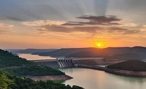
The Sardar Sarovar Dam in Gujarat is the most widely recognised project on the Narmada.
Its water is used for:
- Irrigation
- Drinking-water supply
- Hydroelectricity
- Water distribution to drought-prone areas
2.Indira Sagar Dam
The Indira Sagar Project is located in Madhya Pradesh and has a large reservoir.
It supports both irrigation and hydroelectric power generation.
3.Omkareshwar Dam
Located downstream of Indira Sagar, the Omkareshwar Dam is another important hydropower and irrigation project.
4.Bargi Dam
The Bargi Dam near Jabalpur was among the major projects developed on the Narmada and supports irrigation and electricity generation.
Religious Importance of the Narmada
The Narmada is considered one of the sacred rivers of India and is deeply connected with Hindu traditions.
Omkareshwar, located on an island in the Narmada, is home to one of the twelve Jyotirlingas dedicated to Lord Shiva.
A distinctive tradition associated with the river is the Narmada Parikrama, in which devotees undertake a pilgrimage around the river, traditionally travelling along its banks from the source towards the sea and back.
Important sacred places include:
- Amarkantak
- Omkareshwar
- Maheshwar
- Various historic ghats and temples
Importance of the Narmada River
The Narmada plays a major role in central and western India.
Its importance includes:
- Irrigation: Supplies water to large agricultural areas.
- Drinking water: Reservoirs and canals provide water to numerous settlements.
- Hydroelectricity: Several large projects generate electricity.
- Agriculture: The fertile Narmada Valley supports extensive farming.
- Religious importance: The river is sacred to millions of devotees.
- Tourism: Bhedaghat, Dhuandhar Falls, Omkareshwar and Maheshwar attract visitors.
- Biodiversity: The river supports freshwater and riparian ecosystems.
- Regional development: Water projects support cities, villages, farms and industries.
FAQs
Q1. Where does the Narmada River start and end?
A. The Narmada originates at Narmada Kund in Amarkantak, Madhya Pradesh. It travels approximately 1,312 km westwards and finally enters the Gulf of Khambhat in the Arabian Sea in Gujarat.
Q2. Which states does the Narmada River flow through?
A. The main Narmada River is associated with Madhya Pradesh, Maharashtra and Gujarat. Most of its course lies in Madhya Pradesh, while some stretches form interstate boundaries involving Maharashtra.
Q3. Why does the Narmada River not form a large delta?
A. The Narmada flows through a rift valley and enters the relatively deep waters of the Gulf of Khambhat through an estuary. Its geological setting and coastal conditions are different from east-flowing rivers such as the Godavari and Krishna, which develop extensive deltas.
Q4. Which is the most famous dam on the Narmada River?
A. The Sardar Sarovar Dam in Gujarat is the best-known major project on the Narmada. It is a multipurpose project providing irrigation, drinking water and hydroelectric power, while other major Narmada projects include Indira Sagar, Omkareshwar and Bargi.