The Kosi River is one of the most important and powerful rivers flowing through the eastern Himalayan region into the plains of Bihar. Known for carrying enormous quantities of water and sediment during the monsoon, the Kosi has played a major role in shaping the landscape of north Bihar. It supports agriculture and local livelihoods, but its history of floods and shifting channels has also earned it the well-known name “Sorrow of Bihar.”
The Kosi is a transboundary river whose vast drainage system begins high in the Himalayas of Tibet and Nepal. Several major mountain rivers come together to form the Kosi system before the river enters India through Bihar. From there, it travels across the fertile Gangetic plains and ultimately joins the Ganga River.
The river’s total length is generally given as approximately 720 km, although measurements may vary depending on which headstream is considered. For Indian readers, understanding the Kosi River is particularly important because of its connection with Bihar’s agriculture, floods, embankments, water management and the wider Ganga river system.
Kosi River Overview
| Particular | Details |
|---|---|
| River Name | Kosi River / Koshi River |
| River System | Ganga River System |
| River Type | Transboundary Himalayan river |
| Source Region | Himalayas of Tibet and Nepal |
| Main River Formation | Confluence of major Himalayan tributaries in Nepal |
| Approximate Length | About 720 km |
| Country of Origin System | China (Tibet) and Nepal |
| Indian State | Bihar |
| Major Tributaries/Headstreams | Sun Kosi, Arun and Tamur |
| Important Indian Tributaries | Kamla Balan and other regional streams |
| Final Destination | Ganga River |
| Confluence with Ganga | Bihar |
| Popular Name | Sorrow of Bihar |
Where Does the Kosi River Originate?
Unlike a river with one simple spring as its source, the Kosi has a complex Himalayan origin. Its drainage basin extends across high mountain areas of Tibet and Nepal, including some of the world’s highest terrain.
The river is formed by a network traditionally known as the Sapta Kosi, meaning “Seven Kosis.” Several Himalayan rivers and streams combine to create this extensive system.
Three major components are especially important:
- Sun Kosi
- Arun River
- Tamur River
The Arun has headwaters in the Tibetan region before flowing south into Nepal. The Sun Kosi drains a large part of the Nepal Himalayas, while the Tamur drains areas farther east.
These major rivers eventually combine in Nepal to form the main Kosi, which then flows southward towards the plains and enters India.
Therefore, saying that the Kosi “originates in Nepal” is a useful simplification, but geographically its complete headwater system extends into both Tibet and Nepal.
What Is the Length of the Kosi River?
The Kosi river system is generally described as having a length of approximately 720 kilometres, although figures can vary depending on the headstream used for measurement.
Its journey includes high-altitude Himalayan valleys, steep mountain channels and the flat alluvial plains of Nepal and Bihar.
The change in terrain has a major influence on the behaviour of the river.
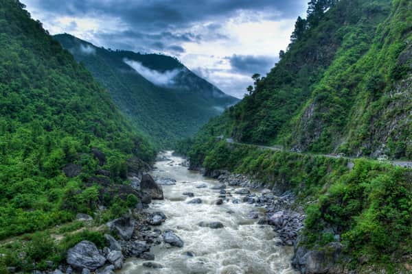
In the mountains, the river moves rapidly and carries large amounts of rock, sand and sediment. Once it reaches the flatter plains, its speed decreases and much of this material begins to settle.
This process contributes to the river’s tendency to alter its channel over long periods.
Which States Does the Kosi River Flow Through in India?
Within India, the main Kosi River flows through Bihar.
Before entering India, it passes through Nepal. The river reaches the Bihar plains near the India-Nepal border and then continues southward towards the Ganga.
Districts and areas of north Bihar have historically been influenced by the Kosi and its floodplain.
The river system is particularly associated with regions around:
- Supaul
- Saharsa
- Madhepura
- Khagaria
- Other parts of north-eastern Bihar
Its water is extremely important for agriculture, but the same river can become dangerous when heavy monsoon rainfall causes water levels to rise sharply.
Course of the Kosi River
The journey of the Kosi can broadly be divided into three geographical stages.
Upper Himalayan Course
The Kosi’s headwaters originate in the high Himalayan region. Rivers such as the Arun, Sun Kosi and Tamur collect water from rainfall, snowmelt and mountain streams.
The steep slopes result in fast-moving water capable of carrying substantial sediment.
Nepal Course
Different headstreams merge within Nepal to form the larger Kosi system.
The main river then moves south towards the plains. Near the Nepal-India border, important flood-control and irrigation infrastructure has been developed to regulate its water.
Bihar Course
After entering Bihar, the river encounters extremely flat terrain.
The sudden reduction in slope means that sediment carried from the mountains is deposited more easily. Over time, sediment accumulation can raise or alter channels and influence the river’s course.
The Kosi eventually continues across Bihar and joins the Ganga River.
Major Tributaries of the Kosi River
The Kosi is famous for its complex network of Himalayan tributaries. Its traditional name, Sapta Kosi, reflects the group of rivers forming the wider drainage system.
1. Arun River
The Arun River is one of the largest components of the Kosi system.
Its upper catchment extends into Tibet, after which it flows through Nepal. Because it drains a large high-altitude region, it contributes significantly to the overall flow of the Kosi.
2. Sun Kosi
The Sun Kosi is another major river in the system and drains a broad area of the Nepal Himalayas.
Several mountain rivers join the Sun Kosi before it becomes part of the main Kosi system.
3. Tamur River
The Tamur River drains the eastern Himalayan region of Nepal.
It carries water from mountainous catchments and ultimately joins the other major streams that form the Kosi.
Other Rivers in the Sapta Kosi System
The wider Sapta Kosi network includes rivers such as:
- Dudh Kosi
- Bhote Kosi
- Tama Kosi
- Likhu
- Indravati
These streams eventually contribute through the larger Sun Kosi-Arun-Tamur network.
Why Is the Kosi Called the “Sorrow of Bihar”?
The Kosi is popularly known as the “Sorrow of Bihar” because of its long history of destructive flooding and changes in its river channel.
The river carries huge quantities of sediment from the young and erosion-prone Himalayan mountains. When it reaches the flat plains of Bihar, its ability to transport this material decreases.
Sediment is then deposited in and around the channel.
Several factors contribute to the Kosi’s flood risk:
- Heavy monsoon rainfall
- Himalayan snowmelt
- Large sediment load
- Very flat terrain in Bihar
- Channel instability
- Pressure on embankments during high flows
- Intense rainfall within the upstream catchment
Historically, the river has shifted across a wide area of the north Bihar plains. Such changes have affected villages, farmland, roads and other infrastructure.
Kosi Barrage and Water Management
An important structure on the river is the Kosi Barrage at Bhimnagar, near the India-Nepal border.
The barrage forms part of a larger system designed to manage river water and support irrigation and flood-control efforts.
The Kosi project includes:
- Barrage infrastructure
- Embankments
- Irrigation canals
- Flood-control measures
- Water-regulation structures
These systems have helped improve the management of the river, but controlling a large Himalayan river carrying substantial sediment remains a difficult engineering and environmental challenge.
Regular maintenance and monitoring of embankments are particularly important before and during the monsoon season.
Importance of the Kosi River for Agriculture
Despite its reputation for flooding, the Kosi is an extremely valuable river for agriculture.
Its floodplain contains fertile alluvial soil deposited over long periods. River water and irrigation infrastructure also support farming across parts of Bihar.
Important crops grown in the wider region include:
- Paddy
- Wheat
- Maize
- Pulses
- Jute
- Sugarcane
- Vegetables
Agriculture remains a major source of livelihood in north Bihar, making effective management of Kosi water essential for local communities.
Kosi River and the Ganga River System
The Kosi is an important left-bank tributary of the Ganga.
After travelling through the Himalayas, Nepal and Bihar, the river finally merges with the Ganga in Bihar.
Its basic route can be understood as:
Tibetan and Nepal Himalayas → Sapta Kosi system → Nepal plains → Bihar → Ganga River
Through the Ganga, Kosi water eventually becomes part of the larger drainage system flowing towards the Bay of Bengal.
The Kosi also carries Himalayan sediments into the Gangetic plains, contributing to the long-term formation and modification of the region’s alluvial landscape.
Why Is the Kosi River Important?
The importance of the Kosi extends beyond its reputation as a flood-prone river.
Some of its major roles include:
- Agriculture: Supports farming and irrigation in north Bihar.
- Fertile soil: Sediment deposition contributes to alluvial soils.
- Water resources: Provides an important freshwater resource.
- Ganga tributary: Forms a major component of the Ganga drainage basin.
- International river: Connects water systems across China, Nepal and India.
- Local livelihoods: Agriculture and other activities depend on its water.
- Geographical significance: Demonstrates how Himalayan rivers shape the Gangetic plains.
- Flood management: Plays a major role in India’s disaster-management planning, especially during the monsoon.
FAQs About the Kosi River
1. Where does the Kosi River originate and where does it end?
A. The Kosi has a complex origin involving several rivers in the Tibetan and Nepal Himalayas. Major rivers including the Arun, Sun Kosi and Tamur combine in Nepal to form the main Kosi. It then enters Bihar and ultimately joins the Ganga River.
2. Which Indian states does the Kosi River flow through?
A. In India, the main Kosi River flows through Bihar. Before entering India, it flows through Nepal, while parts of its upper headwater system extend into Tibet.
3. Why does the Kosi River cause frequent floods in Bihar?
A. The Kosi carries large quantities of sediment from the Himalayas. When the river reaches Bihar’s flat plains, sediment deposition, heavy monsoon flows and the low gradient can increase flood and channel-shifting risks. This history of destructive flooding is why the Kosi is popularly called the “Sorrow of Bihar.”
4. Is Kosi a tributary of the Ganga?
A. Yes. The Kosi is a major left-bank tributary of the Ganga River. It flows south through Bihar before merging with the Ganga and becoming part of the wider Ganga-Brahmaputra drainage system.