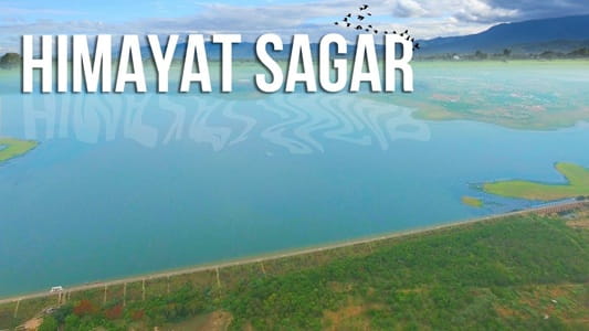
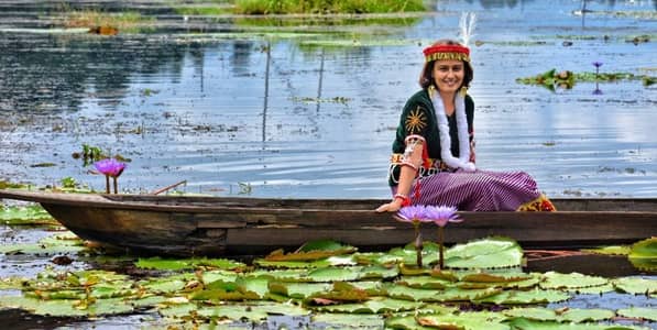
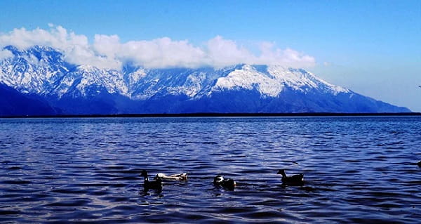
The Brahmaputra River is one of Asia’s great rivers and a defining geographical feature of Northeast India. In Assam, it is impossible to separate the river from everyday life: farming, fishing, transport, wetlands, wildlife habitats and settlements are all closely connected with its enormous river valley. During the monsoon, however, the same river can expand dramatically, causing severe floods and erosion across low-lying areas.
What makes the Brahmaputra particularly fascinating is its international journey. It originates in the Tibetan Plateau, flows eastward across Tibet, turns around the eastern Himalayas and enters India through Arunachal Pradesh. It then crosses the Assam Valley before entering Bangladesh, where it is known mainly as the Jamuna. Eventually, its waters combine with the Ganga-Padma and Meghna river systems before reaching the Bay of Bengal.
The Brahmaputra is approximately 2,900 km long, although estimates vary depending on the source and measurement method. Its enormous drainage basin, Himalayan tributaries and monsoon-fed streams make it one of the most powerful river systems affecting India.
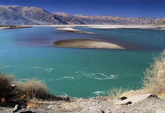
Brahmaputra River Overview
| Particular | Details |
|---|---|
| River Name | Brahmaputra River |
| River Type | Transboundary Himalayan river |
| Source Region | Tibetan Plateau |
| Source | Angsi/Chemayungdung glacier region, southwestern Tibet |
| Approximate Length | Around 2,900 km |
| Name in Tibet | Yarlung Tsangpo |
| Name in Arunachal Pradesh | Siang/Dihang |
| Name in Assam | Brahmaputra |
| Name in Bangladesh | Jamuna |
| Indian States | Arunachal Pradesh and Assam |
| Major Tributaries | Dibang, Lohit, Subansiri, Kameng, Manas, Dhansiri and Kopili |
| Final Drainage | Bay of Bengal through the Ganga-Brahmaputra-Meghna system |
Where Does the Brahmaputra River Originate?
The Brahmaputra originates in the Tibetan Plateau, north of the Himalayan mountain range. Its source is associated with the glacier-fed headwaters of southwestern Tibet, in the wider region near Lake Manasarovar and Mount Kailash.
In Tibet, the river is known as the Yarlung Tsangpo or Yarlung Zangbo. It flows eastward for a considerable distance, following the high-altitude Yarlung Tsangpo Valley.
The Tibetan Plateau is one of the world’s highest regions, so the upper Brahmaputra flows through a cold, dry and mountainous environment very different from the humid plains of Assam.
Important facts about the Brahmaputra’s origin:
- It originates in the Tibetan Plateau.
- Its headwaters are fed by glaciers and snowmelt.
- It is called the Yarlung Tsangpo in Tibet.
- It initially flows mainly eastward.
- It eventually turns south towards India around the eastern Himalayan region.
What Is the Length of the Brahmaputra River?
The Brahmaputra has an approximate total length of 2,900 kilometres.
Different geographical references may provide somewhat different figures because the exact identification of a river’s ultimate source and modern methods of measuring its winding course can affect the calculated length.
The river’s journey can broadly be divided into three international sections:
- China (Tibet): Yarlung Tsangpo
- India: Siang/Dihang and Brahmaputra
- Bangladesh: Jamuna
It eventually becomes part of the vast river network that empties into the Bay of Bengal.
Which States Does the Brahmaputra River Flow Through in India?
The main Brahmaputra flows through two Indian states:
- Arunachal Pradesh
- Assam
However, its wider drainage basin and tributaries extend into other parts of Northeast India.
1. Arunachal Pradesh
After travelling across Tibet, the river makes a dramatic turn near the eastern Himalayas and enters India through Arunachal Pradesh.
Here, the river is commonly known as the Siang. As it descends from the mountains, it passes through steep valleys and receives water from numerous Himalayan streams.
Further downstream, after the Siang is joined by important rivers including the Dibang and Lohit, the combined river becomes known as the Brahmaputra.
The transition from mountainous Arunachal Pradesh to the Assam plains also produces a major change in the river’s character.
2. Assam
The Brahmaputra then flows westward across the length of the Assam Valley.
In Assam, it becomes an extremely wide river with multiple channels, sandbars and river islands. The river receives numerous tributaries flowing down from the Himalayas in the north and hill systems in the south.
Important cities and towns associated with the river include:
- Dibrugarh
- Tezpur
- Guwahati
- Goalpara
- Dhubri
After crossing western Assam, the Brahmaputra enters Bangladesh.
Course of the Brahmaputra River from Tibet to the Sea
The Brahmaputra’s route is remarkable because it passes through some of the world’s highest mountains before reaching one of its largest delta regions.
1. Upper Course in Tibet
As the Yarlung Tsangpo, the river flows eastward across southern Tibet.
It travels through a high-altitude valley between major mountain ranges. Near the eastern Himalayas, it bends sharply and begins descending towards India through deep gorges.
2. Course Through Arunachal Pradesh
On entering Arunachal Pradesh, the river is known as the Siang.
Its gradient is steep in the mountainous region, resulting in fast-flowing water. After reaching lower elevations, the Siang joins the Dibang and Lohit rivers.
The combined flow develops into the Brahmaputra.
3. Course Through Assam
Across Assam, the river becomes broader and slower.
The Assam Valley has a relatively gentle gradient, encouraging the formation of multiple channels, sandbars and islands.
The river’s channel can change over time due to:
- Heavy sediment deposition
- Bank erosion
- Monsoon floods
- Changes in individual channels
4. Course Through Bangladesh
After leaving India, the river enters Bangladesh and is known primarily as the Jamuna.
It eventually joins the Padma, which carries the waters of the Ganga system. These waters later combine with the Meghna before entering the Bay of Bengal through the vast Ganga-Brahmaputra-Meghna delta.
Major Tributaries of the Brahmaputra River
The Brahmaputra receives water from a large number of tributaries. Many originate in the Himalayas, while others drain hills and plateaus south of the Assam Valley.
1. Dibang River
- The Dibang River originates in the mountainous region of Arunachal Pradesh.
- It flows southward and joins the Siang-Brahmaputra system in the eastern part of the Assam region.
2. Lohit River
- The Lohit is another major eastern tributary. It flows through Arunachal Pradesh before joining the main river system.
- Together, the Siang, Dibang and Lohit form the great river that continues across Assam as the Brahmaputra.
3. Subansiri River
- The Subansiri is one of the largest tributaries of the Brahmaputra in India.
- It originates in the Tibetan Himalayan region, flows through Arunachal Pradesh and enters Assam before meeting the Brahmaputra.
4. Kameng River
- The Kameng River, known as Jia Bharali in parts of Assam, flows from Arunachal Pradesh into Assam and joins the Brahmaputra.
- Its catchment includes mountainous and forested areas.
5. Manas River
- The Manas River originates in the Himalayan region and flows through Bhutan before entering Assam.
- Its basin includes ecologically rich landscapes, including areas around Manas National Park.
6. Dhansiri River
- The Dhansiri drains areas south of the Brahmaputra Valley and is an important tributary in Assam.
7. Kopili River
- The Kopili River is another important southern tributary of the Brahmaputra system. Its drainage area includes parts of Meghalaya and Assam.
Why Is the Brahmaputra So Wide in Assam?
One of the most striking characteristics of the Brahmaputra is its enormous width in Assam.
Several factors contribute to this:
- Large volume of water from Himalayan tributaries
- Heavy monsoon rainfall
- Huge sediment load
- Relatively flat Assam Valley
- Frequent erosion and deposition
- Formation of multiple river channels
These conditions create a braided river system, where the water divides into several interconnected channels separated by sandbars and islands.
This also explains why the river’s exact width varies greatly by location and season.
Majuli and the Brahmaputra
Majuli, situated within the Brahmaputra river system in Assam, is one of India’s best-known inhabited river islands.
The island is famous for its:
- Assamese cultural traditions
- Vaishnavite Satras
- Rural communities
- Wetlands
- Agriculture
- Distinctive riverine landscape
However, Majuli has also experienced significant riverbank erosion over the years, demonstrating the constantly changing nature of the Brahmaputra.
Why Does the Brahmaputra Cause Floods in Assam?
Flooding is a natural characteristic of the Brahmaputra basin, particularly during the southwest monsoon.
Heavy rainfall across Northeast India and the Himalayan catchment dramatically increases river discharge. At the same time, tributaries carry large quantities of sediment into the main channel.
Important factors behind flooding include:
- Intense monsoon rainfall
- Water from numerous tributaries
- Snow and glacier melt
- Heavy sediment load
- Erosion and shifting river channels
- Low-lying floodplains
Floods can damage homes, roads, farmland and infrastructure. At the same time, natural flooding also deposits nutrient-rich alluvial sediment across parts of the floodplain.
Economic and Environmental Importance of the Brahmaputra
The Brahmaputra is essential to the economy and ecology of Northeast India.
Its major benefits include:
- Agriculture: Provides water and fertile alluvial soil for farming.
- Fisheries: Supports fish resources and fishing communities.
- Transport: Inland waterways provide transportation opportunities.
- Hydropower: Himalayan tributaries offer significant hydroelectric potential.
- Freshwater: Supports communities across the river basin.
- Wetlands: Feeds numerous wetlands and floodplain ecosystems.
- Biodiversity: Supports habitats important for fish, birds and other wildlife.
- Tourism: River cruises, islands and waterfront landscapes attract visitors.
The river is closely connected with Assam’s culture, festivals, livelihoods and traditional settlement patterns.
FAQs About the Brahmaputra River
Q1. Where does the Brahmaputra River originate and where does it end?
A. The Brahmaputra originates in the Tibetan Plateau, where it is known as the Yarlung Tsangpo. It flows through China, India and Bangladesh before its waters ultimately reach the Bay of Bengal through the Ganga-Brahmaputra-Meghna river system.
Q2. Which Indian states does the main Brahmaputra River flow through?
A. The main Brahmaputra flows through Arunachal Pradesh and Assam in India. However, tributaries within its wider drainage basin also collect water from several other northeastern states.
Q3. Why is the Brahmaputra called Siang in Arunachal Pradesh?
A. When the Yarlung Tsangpo enters Arunachal Pradesh, its Indian upper course is commonly called the Siang. After it descends towards the plains and combines with major rivers such as the Dibang and Lohit, the river is known as the Brahmaputra.
Q4. Is the Brahmaputra a tributary of the Ganga?
A. No. The Brahmaputra is a major river system in its own right, not simply a tributary of the Ganga. In Bangladesh, the Brahmaputra’s Jamuna channel joins the Padma, which carries the Ganga’s waters. Their combined waters later join the Meghna and eventually flow into the Bay of Bengal.