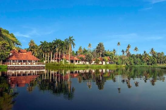
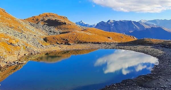
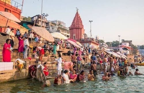
Somewhere beneath the calm waters of Panchet reservoir lie the submerged ruins of a kingdom that once stood for nearly two thousand years. That’s the kind of story most visitors never expect when they plan a simple picnic trip to this Dhanbad-area dam. Panchet isn’t just another spot to click photos against green hills — it’s part of independent India’s very first coordinated flood-control experiment, and its history carries both engineering pride and a genuinely difficult human story. If you’re planning a trip through Jharkhand’s industrial belt, here’s everything worth knowing before you go.
Panchet Dam Quick Overview
| Detail | Information |
| River | Damodar River, near its confluence with the Barakar |
| Location | Panchet, Dhanbad district, Jharkhand |
| Distance from Dhanbad | Around 54–55 km |
| Distance from Asansol | About 20 km |
| Distance from Chirkunda | Roughly 9 km |
| Nearest Railway Station | Kumardhubi, about 9–10 km away |
| Nearest Airport | Kolkata (around 235 km) or Ranchi |
| Developed By | Damodar Valley Corporation (DVC) |
| Inaugurated | 1959, by Prime Minister Jawaharlal Nehru |
| Sequence in DVC Project | Fourth and last dam of DVC’s first phase |
| Dam Type | Earthen dam with concrete spillway |
| Dam Length | Around 6,777 metres |
| Dam Height | About 45 metres |
| Reservoir Area | Roughly 28 sq. km |
| Power Generation | 80 MW hydroelectric capacity |
| Entry Fee | Generally free |
| Best Time to Visit | Post-monsoon through winter |
Where Panchet Dam Is Located
Panchet Dam sits in Dhanbad district, Jharkhand, about 54 to 55 kilometres from Dhanbad city itself and roughly 20 kilometres from Asansol. It’s positioned just above the point where the Damodar River meets the Barakar, which means the reservoir it creates actually forms a natural boundary — Dhanbad district sits on the northern bank, while Purulia district in West Bengal occupies the southern side.
The dam is easily reached via Grand Trunk Road, about 9 kilometres from Chirkunda, and Kumardhubi serves as the nearest railway station, connecting well through the Grand Chord Line. Many travellers combine a Panchet visit with a stop at nearby Maithon Dam, since both fall under the same DVC network and sit within a reasonable driving distance of each other.
The River Behind This Historic Project
Panchet Dam is built across the Damodar River, one of eastern India’s most historically flood-prone waterways. Towering above the dam is Panchet Hill, which lends the structure both its name and much of its scenic appeal, with green slopes forming a dramatic backdrop against the blue reservoir waters.
The Damodar’s reputation for devastating floods is precisely why this dam exists. Before these control measures were in place, the river’s unpredictable flow caused repeated destruction across Bengal and Bihar, and it was this recurring crisis that eventually led to one of independent India’s most ambitious river-management projects.
A History Born from Disaster
The story of Panchet Dam begins with catastrophe. A devastating flood in 1943 prompted the Governor of Bengal to set up the Damodar Flood Enquiry Committee to figure out how to prevent future disasters. Their recommendation was bold for its time — model a new authority on the Tennessee Valley Authority in the United States, and W.L. Voorduin, a senior TVA engineer, helped draft the original plan covering flood control, irrigation, power generation, and navigation.
This led to the creation of the Damodar Valley Corporation, and Panchet Dam was the fourth and final dam built under DVC’s first development phase. The sequence tells its own story of scale: Tilaiya on the Barakar came first in 1953, followed by the Konar dam in 1955, then Maithon in 1957, and finally Panchet in 1959.
What’s less commonly discussed is what the reservoir submerged to make this possible. The village of Telkupi, once the capital of the ancient Tilakampa Kingdom and likely connected to the Panchakot Raj, disappeared beneath Panchet’s waters. Historical surveys from the early 1900s described Telkupi as home to one of the largest concentrations of temples anywhere in the region, dating back to the 1st century AD. Today, only scattered ruins near the southern foothills survive as a reminder of what was lost.
The Story Behind the Dam’s Inauguration
When Nehru arrived in 1959 to formally inaugurate Panchet Dam, officials chose two young Santhal tribal girls, project workers named Budhni Mejhan and Robon Majhi, to welcome him. Budhni garlanded the Prime Minister as part of the ceremony — a moment that should have been celebratory, but instead triggered a devastating consequence for her personally. Her village elders interpreted the garlanding as a symbolic marriage, and since Nehru wasn’t part of the Santhal community, she was cast out from her own village for supposedly marrying outside it.
Budhni later found refuge with a local resident and had a daughter, who was also rejected by the community. She was eventually let go from her DVC staff position in 1962, though Prime Minister Rajiv Gandhi reinstated her decades later, in 1985. Even so, both Budhni and her daughter reportedly remained social outcasts from their original village. It’s a sobering piece of the dam’s history that rarely makes it into typical tourist descriptions, but it’s genuinely part of the human cost behind this engineering achievement.
What Panchet Dam Does Today
Functionally, Panchet Dam continues to serve its original purpose of flood control, alongside generating around 80 MW of hydroelectric power. Research on the Damodar basin has shown that Panchet and Maithon together significantly reduced both the frequency and severity of flooding downstream, cutting what were once ten-year flood events roughly in half.
Looking ahead, DVC has plans to add solar power generation at Panchet, with proposals for roughly 105 MW of floating solar panels on the reservoir surface itself, alongside 50 MW of ground-mounted rooftop panels, with generation expected to begin in the following years.
What There Is to Do at Panchet Dam
The dam’s most obvious draw is simply the view — Panchet Hill rising behind still reservoir waters makes for a genuinely picturesque picnic setting, particularly popular during the winter months around Christmas and New Year. A DVC-maintained garden sits adjacent to the dam, though several recent visitor reports note that its upkeep has declined over the years.
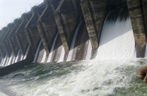
Photography is generally welcomed here, and the contrast between the dam’s massive spillway gates and the surrounding greenery makes for striking shots, especially when the gates are opened during peak monsoon discharge. For those interested in a bit of local history, the ruins of Garh Panchakot lie within easy reach, offering a tangible link to the region’s pre-dam past. Birdwatchers also frequent the area, since the reservoir attracts a range of migratory species during the cooler months.
Timings and Entry Details
Panchet Dam is generally free to visit, with no formal entry fee reported by most current sources, though it’s always sensible to confirm this locally since policies can shift. Early morning and evening are considered the best times to visit, both for cooler weather and better lighting for photography.
One important seasonal detail worth knowing — the dam’s gates are typically closed during the monsoon season for water regulation purposes, which means the full spectacle of open spillway gates is usually only visible right at the tail end of monsoon or just as winter begins.
Frequently Asked Questions
Q1. Is there an entry fee to visit Panchet Dam?
Generally no, most current sources report free entry, though it’s worth confirming locally as policies and regulations can change over time.
Q2. What’s the best time to see the dam’s spillway gates open?
Right at the end of monsoon season, when water levels are still high and authorities release excess water, offers the best chance to witness the gates in action, since they typically stay closed for most of the rainy season itself.
Q3. Is swimming allowed in the Panchet reservoir?
No, swimming near the dam is generally discouraged or prohibited due to slippery banks and unpredictable water levels, especially during and right after monsoon. It’s best to admire the reservoir from designated viewing areas instead.
Q4. Can I combine a Panchet Dam visit with other nearby attractions?
Yes, Maithon Dam is roughly 15 kilometres away and falls under the same DVC network, while Garh Panchakot and Kalyaneshwari Temple are also within a reasonable driving distance, making it easy to plan a fuller day trip around the region.