If Mattupetty Dam is the Munnar dam every tourist already knows about, Kundala Dam is the one seasoned travellers quietly recommend instead. Ask anyone who’s visited both, and you’ll often hear the same thing — Kundala’s scenery, boating, and overall atmosphere genuinely edges out its more famous neighbour. This is also Asia’s first arch dam, a genuine engineering milestone tucked into Kerala’s tea country. If you’re planning your Munnar itinerary, here’s everything worth knowing.
Quick Overview
| Detail | Information |
| Also Known As | Sethuparvathy Dam |
| River | Muthirapuzha River, a tributary of the Periyar |
| Location | Mattupetty panchayat, Idukki district, Kerala |
| Distance from Munnar | Around 20–25 km |
| Nearest Airport | Cochin International Airport, around 110–131 km |
| Nearest Railway Station | Aluva, roughly 120–132 km away |
| Part of | Pallivasal Hydroelectric Project, Kerala’s first hydroelectric project |
| Completed | 1946–47 |
| Status | Asia’s first arch dam |
| Dam Type | Masonry arch dam |
| Dam Height | 46.93 metres |
| Dam Length | 259.38 metres |
| Storage Capacity | 7.65 million cubic metres at full reservoir level |
| Elevation | Around 1,700–1,759 metres above sea level |
| Visiting Hours | 9:00 AM to 5:00 PM (boating until 4:30–5:30 PM) |
| Entry Fee | Free; boating charged separately |
| Best Time to Visit | October to March |
Where Kundala Dam Is Located
Kundala Dam sits roughly 20 to 25 kilometres from Munnar town, within Mattupetty panchayat in Idukki district, along the road heading toward Top Station. This makes it a genuinely convenient stop if you’re already exploring that stretch of Munnar’s sightseeing circuit, since Mattupetty Dam and Echo Point fall along the same general route.
Getting to Munnar itself typically involves flying into Cochin International Airport, roughly 110 to 131 kilometres away depending on the exact route, or arriving by train at Aluva or Ernakulam Junction before continuing by road. From Munnar town, local taxis or sightseeing vehicles handle the final stretch to Kundala via the Munnar-Mattupetty-Top Station road.
The River Behind This Arch Dam
Kundala Dam is built across the Muthirapuzha River, a tributary that eventually feeds into the larger Periyar River system, one of Kerala’s most significant waterways. Some sources describe the dam as sitting directly on the Periyar itself, but more precise technical records point to the Muthirapuzha specifically, with the Periyar connection coming through this tributary relationship rather than a direct build.
What makes Kundala’s water management genuinely interesting is its downstream role — water released from this reservoir flows through the Palar River, eventually reaching Mattupetty Dam further downstream, before continuing to serve multiple taluks including Udumbanchola, Devikulam, Kothamangalam, Muvattupuzha, and several others stretching all the way to Aluva and Paravur near the coast.
A History Rooted in Kerala’s First Hydroelectric Project
Kundala Dam was completed in 1946-47, and it holds a genuinely significant place in Kerala’s industrial history as part of the Pallivasal Hydroelectric Project, the very first hydroelectric initiative undertaken in the state. Its masonry arch design earned it recognition as Asia’s first arch dam, a distinction that reflects how technically advanced this project was for its time.
The dam’s original name, Sethuparvathy Dam, honoured a queen, and this naming detail still comes up when visiting, with security staff and guides at the site occasionally sharing this bit of history with tourists. Over the decades, the name gradually shifted to Kundala, the name by which it’s almost universally known today.
From Colonial-Era Infrastructure to Munnar’s Favourite Lake
Kundala’s transformation from a purely functional hydroelectric structure into one of Munnar’s most beloved tourist attractions happened gradually, much like similar dams across Kerala’s hill country. What started as infrastructure supporting plantation power needs and water regulation in the High Range area has become a genuinely significant part of the local tourism economy, with boating and sightseeing now forming a primary livelihood source for many residents in the surrounding villages.
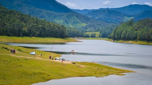
The reservoir, Kundala Lake, was formed at the confluence of three mountain streams, and its setting amid rolling hills, dense tea plantations, and misty peaks has made it one of the most photographed spots in the entire Munnar region.
What Makes Kundala Genuinely Special
Beyond the dam’s engineering history, this area is known for two genuinely rare natural phenomena. Cherry blossom trees in the vicinity flower twice a year, adding a splash of colour that catches many visitors by surprise, though exact bloom timing isn’t officially documented and can vary. Even more remarkable, the surrounding hills occasionally showcase the famous Neelakurinji flowers, which bloom only once every twelve years, turning entire slopes a vivid purple hue for those lucky enough to time their visit right.
A Tata Tea-owned golf course in Kundala village adds another unexpected layer to the area’s character, reflecting the deep connection between this region and Kerala’s historic tea plantation industry.
What There Is to Do at Kundala Dam
Boating remains the undisputed highlight here, with pedal boats, row boats, and Kashmiri-style shikara boats all available for hire. A typical ride lasts around 30 minutes, with pricing generally running ₹100 for a 2-seater pedal boat, ₹150 for a 4-person row boat, and ₹200 for a 2-person shikara ride, though rates can vary slightly by operator and season. Several visitors specifically recommend the shikara and coracle boat experiences as the most memorable way to take in the surrounding tea-plantation-covered hills.
Beyond boating, simply sitting by the lake with a cup of masala tea from a nearby stall, watching boats drift across the water against a backdrop of green hills, is genuinely one of the more relaxing experiences Munnar has to offer. Horse rides along the lake’s banks, occasional elephant rides, and photography opportunities round out a typical visit, and small food stalls nearby serve snacks like dosa and sandwiches if you’re not carrying your own.
Timings and Entry Details
Kundala Dam and its lake are generally open daily from 9:00 AM to 5:00 PM, with boating typically wrapping up between 4:30 and 5:30 PM depending on the specific operator. Entry to the dam and lake area itself is free, with charges applying only to boating and any additional activities like horse rides.
Given how popular this spot has become, most visitors comfortably spend one to two hours here, making it easy to combine with other stops along the Munnar-Top Station route in a single day’s sightseeing.
Best Time to Plan Your Visit
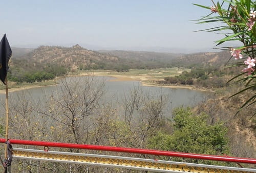
October through March offers the most comfortable weather for visiting, with cooler temperatures and clearer skies making both the boating experience and general sightseeing genuinely pleasant. It’s worth being aware that water levels can drop noticeably during the drier summer months, particularly around April and May, which several visitors have noted reduces the visual appeal and can even limit boating activity, so planning your trip for the post-monsoon to winter window generally gives you the best version of Kundala Lake.
Frequently Asked Questions
Q1. Why is Kundala Dam sometimes called Sethuparvathy Dam?
That was its original name, given in honour of a queen at the time of construction. Over the decades, common usage shifted to Kundala, the name by which it’s now widely known, though some guides and security staff at the site still share this historical detail with visitors.
Q2. Is Kundala Dam better than Mattupetty Dam for boating?
Many visitors genuinely prefer Kundala, citing its scenery and boating variety, including shikara and coracle rides, as more memorable than Mattupetty’s offerings. That said, both are worth visiting if your itinerary allows, since they’re along the same general route and offer slightly different experiences.
Q3. What happens to the water level during summer, and does it affect the visit?
Water levels can drop noticeably during the drier months, particularly April and May, which reduces the visual appeal and can sometimes limit boating availability. Visiting between October and March generally ensures a fuller, more scenic reservoir.
Q4. Can I see the rare Neelakurinji flowers during a regular Munnar trip?
Only if your timing coincides with their extremely rare 12-year blooming cycle, which covers the surrounding hills in a striking purple hue when it happens. Outside of that specific window, the hills remain green year-round, so it’s not something you can reliably plan a trip around.