The Ghaghara River is one of the major Himalayan rivers of northern India and an important tributary of the Ganga. Carrying water from the high Tibetan Plateau and the Himalayas through Nepal into the fertile plains of Uttar Pradesh and Bihar, the river plays an important role in agriculture, groundwater recharge, wetlands and the overall drainage system of the Gangetic plains. At the same time, its high monsoon discharge makes flooding an important concern for communities living near its banks.
The river is known by different names during its long journey. Its upper course is associated with the Karnali system in Tibet and Nepal, while it is generally known as the Ghaghara after entering the Indian plains. The entire river system is approximately 1,080 km long, although length figures can vary depending on which upper headstream is considered.
In India, the main Ghaghara flows primarily through Uttar Pradesh and Bihar before joining the Ganga near Revelganj in the Chhapra region of Bihar. Tributaries such as the Sharda, Rapti and Little Gandak expand its drainage network across the Himalayan foothills and Gangetic plains. Understanding its origin and course is particularly useful for Indian geography because the Ghaghara is among the Ganga’s most significant tributaries by water discharge.
Ghaghara River Overview
| Particular | Details |
|---|---|
| River Name | Ghaghara River |
| Upper-Course Name | Karnali |
| River System | Ganga River System |
| Source Region | Tibetan Plateau near the Himalayas |
| Approximate Length | Around 1,080 km |
| Countries | China (Tibet), Nepal and India |
| Main Indian States | Uttar Pradesh and Bihar |
| Major Tributaries | Sharda, Rapti, Little Gandak, Seti and Bheri |
| General Flow Direction | Generally south and southeast |
| River Type | Perennial Himalayan river |
| Final Confluence | Ganga River |
| Confluence Area | Near Revelganj/Chhapra, Bihar |
| Major Concern | Monsoon flooding |
Where Does the Ghaghara River Originate?
The Ghaghara river system originates in the high Tibetan Plateau near the Himalayan region, north of Nepal.
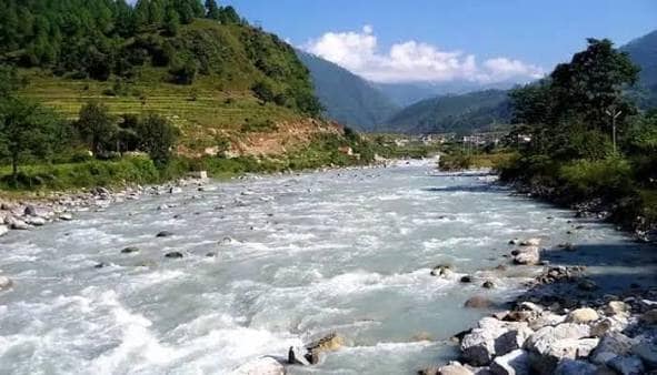
In its upper reaches, the river is associated with the Karnali, which flows southwards from Tibet into Nepal. The Karnali cuts through rugged Himalayan terrain and receives water from numerous snow-fed and rain-fed mountain streams.
After crossing the Himalayas, the river reaches the lower terrain of Nepal and eventually enters India.
The different names used for the river can sometimes cause confusion. A simple way to understand the system is:
- Upper Himalayan system: Karnali
- Course through Nepal: Karnali
- Indian plains: Ghaghara
- Final river system: Ganga
Because the river originates in a high Himalayan environment, its flow is influenced by both mountain runoff and seasonal monsoon rainfall.
What Is the Length of the Ghaghara River?
The Ghaghara-Karnali river system is generally stated to be approximately 1,080 kilometres long, although estimates vary depending on the headstream and measurement method used.
Its course stretches across three geographical regions: the Tibetan Plateau, the Himalayas of Nepal and the Gangetic plains of India.
The river is particularly significant because of the large quantity of water it carries. It is considered one of the largest tributaries of the Ganga by discharge.
During the monsoon season, heavy rainfall across Nepal and northern India can rapidly increase its water level.
Which States Does the Ghaghara River Flow Through in India?
The main Ghaghara River flows through or along:
- Uttar Pradesh
- Bihar
Its wider drainage system is much larger because tributaries collect water from different parts of Nepal and northern India.
Ghaghara River in Uttar Pradesh
After leaving Nepal, the river enters the plains of Uttar Pradesh, where it becomes a broad and powerful river.
It flows through or influences several districts of eastern Uttar Pradesh.
Areas associated with the river system include regions around:
- Bahraich
- Sitapur
- Barabanki
- Ayodhya
- Gonda
- Basti
- Gorakhpur
- Ballia
In the Ayodhya region, a channel of the Ghaghara is traditionally known as the Saryu or Sarayu, a name of great religious importance.
The river’s water and fertile floodplains support agriculture throughout eastern Uttar Pradesh.
Ghaghara River in Bihar
The Ghaghara reaches Bihar near the lower part of its course.
It finally joins the Ganga near Revelganj, close to Chhapra in Saran district.
The confluence adds a substantial volume of water to the Ganga before the river continues eastwards across Bihar.
Course of the Ghaghara River
The river’s journey can broadly be divided into three sections.
Upper Course in Tibet
The headwater system begins in the high-altitude Tibetan region.
Here, the landscape is mountainous and sparsely populated. Water from snowmelt, glaciers, precipitation and mountain streams feeds the upper river.
Himalayan Course Through Nepal
After entering Nepal, the river is known primarily as the Karnali.
It cuts through deep Himalayan valleys and receives several important tributaries, including the Bheri and Seti.
The Karnali basin is one of Nepal’s major river systems and contains extensive mountain and forest ecosystems.
Lower Course in India
After reaching the plains, the river becomes the Ghaghara.
The gradient decreases considerably, allowing the river to develop a wider channel and floodplain.
It travels across eastern Uttar Pradesh, receives additional tributaries and finally reaches Bihar before joining the Ganga.
Major Tributaries of the Ghaghara River
The Ghaghara-Karnali system has several important tributaries originating in both the Himalayan and plains regions.
1. Bheri River
The Bheri River is an important tributary of the Karnali system in Nepal.
It drains mountainous areas and contributes significant water to the main river.
2. Seti River
The Seti River is another major component of the Karnali-Ghaghara drainage system in Nepal.
It originates in the Himalayan region and joins the Karnali system before its waters eventually enter India.
3. Sharda River
The Sharda, also associated with the Mahakali system in its upper reaches, is an important river of the region.
It forms part of the India-Nepal boundary for a section of its course and ultimately contributes to the Ghaghara system in the plains.
4. Rapti River
The Rapti River is an important tributary of the Ghaghara.
It flows through Nepal before entering Uttar Pradesh and passes through areas of eastern UP before joining the Ghaghara.
The Rapti is also known for seasonal flooding during periods of heavy monsoon rainfall.
5. Little Gandak
The Little Gandak flows through the eastern Gangetic plains and joins the Ghaghara system.
It should not be confused with the much larger Gandak River, which is a separate tributary of the Ganga.
Important tributaries to remember include:
- Bheri
- Seti
- Sharda
- Rapti
- Little Gandak
Ghaghara and Saryu: Are They the Same River?
The names Ghaghara and Saryu can create confusion because they are sometimes used differently in geographical and religious contexts.
In the Ayodhya region, the river flowing past the sacred city is widely known as the Saryu. It is associated with the broader Ghaghara river system.
The Saryu has exceptional cultural significance because Ayodhya is traditionally associated with Lord Rama.
For general geographical understanding, it is useful to remember that the Ghaghara is the major river system, while the name Saryu is strongly associated with its course around Ayodhya and with historical and religious traditions.
Why Does the Ghaghara Cause Flooding?
Flooding is one of the most important geographical features associated with the Ghaghara.
The river drains a huge area extending from high Himalayan mountains to low-lying Gangetic plains.
During the monsoon, several factors can increase flood risk:
- Heavy rainfall in Nepal
- Intense rainfall in eastern Uttar Pradesh
- High discharge from tributaries
- Sediment deposition
- Low gradient in the plains
- Shifting river channels
- Reduced capacity of local drainage systems
- Overflow into natural floodplains
Floods can damage crops, roads, houses and other infrastructure. However, natural flooding also deposits fresh sediment and contributes to the fertility of floodplain soils.
Importance of the Ghaghara for Agriculture
Agriculture is one of the biggest beneficiaries of the Ghaghara river system.
The river and its tributaries contribute water and fertile alluvial sediments to the plains of eastern Uttar Pradesh and Bihar.
Major crops grown in areas influenced by the river system include:
- Rice
- Wheat
- Sugarcane
- Maize
- Pulses
- Mustard
- Vegetables
Groundwater recharge from rivers, wetlands and floodplains also supports irrigation wells used by farmers.
Ecological Importance of the Ghaghara
The Ghaghara is not only important for people but also supports diverse freshwater ecosystems.
Its channels, sandbanks, wetlands and floodplains provide habitats for numerous species.
The river system can support:
- Freshwater fish
- Gangetic river dolphins
- Turtles
- Migratory and resident birds
- Wetland vegetation
- Other aquatic species
Maintaining adequate river flow and reducing pollution are important for protecting these habitats.
Religious and Cultural Importance
The river has deep cultural importance, particularly because of its association with Ayodhya and the Saryu.
Ghats along the river are used for:
- Religious bathing
- Festivals
- Prayer ceremonies
- Traditional rituals
- Pilgrimage activities
The river therefore forms an important connection between northern India’s physical geography and its religious heritage.
Why Is the Ghaghara River Important?
The Ghaghara has geographical, agricultural, ecological and cultural importance.
Its major contributions include:
- Ganga water system: It is one of the Ganga’s largest tributaries by discharge.
- Agriculture: Supports fertile farming regions in eastern Uttar Pradesh and Bihar.
- Groundwater recharge: Helps replenish water beneath surrounding floodplains.
- Biodiversity: Supports important freshwater habitats and species.
- Cultural importance: Closely associated with Ayodhya through the Saryu.
- International drainage: Connects the Tibetan Plateau, Nepal and India.
- Fertile plains: Deposits sediment across its floodplain.
- Local livelihoods: Supports farming, fishing and other river-based activities.
FAQs About the Ghaghara River
1. Where does the Ghaghara River originate and where does it end?
A. The Ghaghara-Karnali system originates in the Tibetan Plateau near the Himalayan region, flows through Nepal as the Karnali and enters the Indian plains as the Ghaghara. It ultimately joins the Ganga near Revelganj in the Chhapra region of Bihar.
2. Which states does the Ghaghara River flow through in India?
A. The main Ghaghara flows through Uttar Pradesh and Bihar in India. Its wider drainage basin extends into other areas through tributaries, while a substantial portion of the upper river system lies in Nepal and Tibet.
3. Are the Ghaghara, Karnali and Saryu the same river?
A. They are closely connected names within the same broader river system, but their usage depends on location and context. Karnali is the principal name used for the upper river in Nepal, while Ghaghara is commonly used in the Indian plains. Around Ayodhya, the river is traditionally known as the Saryu or Sarayu.
4. Why is the Ghaghara River important to the Ganga?
A. The Ghaghara has a very large Himalayan catchment and carries a substantial volume of water. When it joins the Ganga in Bihar, it makes a major contribution to the Ganga’s overall flow, particularly during the monsoon season.