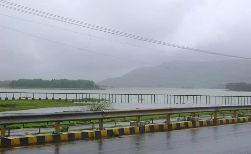
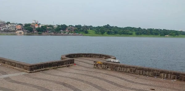
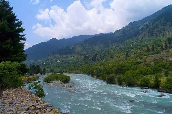
Ask anyone from Kolkata about their favourite winter picnic spot outside the city, and there’s a genuine chance Mukutmanipur comes up. This is India’s second-largest earthen dam, sitting at the confluence of three rivers, and locals proudly call it the “Queen of Bankura” for good reason. If you’ve been searching for a weekend escape that mixes red-earth landscapes, tribal culture, and a genuinely massive reservoir, here’s everything worth knowing before you plan your trip.
Quick Overview
| Detail | Information |
| Also Known As | Kangsabati Barrage |
| Rivers | Kangsabati (Kasai), Kumari, and Shilabati rivers meet here |
| Location | Khatra subdivision, Bankura district, West Bengal |
| Distance from Bankura Town | Around 52–55 km |
| Distance from Kolkata | About 230–270 km |
| Nearest Railway Station | Bankura Railway Station, around 55 km away |
| Nearest Airport | Netaji Subhas Chandra Bose International Airport, Kolkata (212–240 km) |
| Status | Second-longest earthen dam in India (after Sriram Sagar Project, Telangana) |
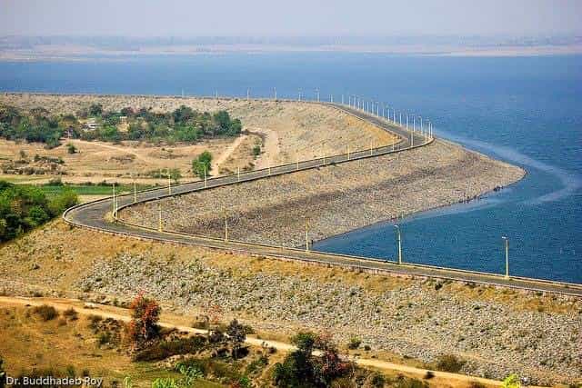
| Dam Length | Around 10.8–11.27 km |
| Dam Height | Around 38 metres (125 feet) |
| Reservoir Area | Around 65–86 sq. km (sources vary) |
| Gross Storage Capacity | 1.04 cubic km (36.73 TMC) |
| Irrigation Coverage | Around 8,000 sq. km across four districts |
| Bird Species Recorded | Over 160, with 5,000+ migratory birds arriving each winter |
| Best Time to Visit | October to March; monsoon for open lock gates |
Where Mukutmanipur Dam Is Located
Mukutmanipur Dam sits in Khatra subdivision of Bankura district, close to the Jharkhand border, roughly 52 to 55 kilometres from Bankura town. Its remote, semi-forested setting is exactly what gives the area its distinctive character, with hillocks encircling the reservoir almost like a crown, which is genuinely where the name “Mukut” comes from.
Getting here typically involves a train journey from Howrah to Bankura, taking around 4.5 hours, followed by a roughly two-hour bus ride or a faster one-hour taxi drive covering the remaining distance. Direct buses also run from Kolkata, though this route takes closer to nine hours, making the train-plus-local-transport combination the more practical choice for most visitors. Kolkata’s international airport, at 212 to 240 kilometres away, remains the nearest air link for those travelling from further afield.
The Rivers Behind This Massive Reservoir
What makes Mukutmanipur genuinely unique among Indian dams is its position at the meeting point of three rivers — the Kangsabati (also known as the Kasai or Kumari in different stretches), the Kumari, and the Shilabati. The Kangsabati itself originates in the Chota Nagpur Plateau and flows through Purulia, Bankura, and Paschim Medinipur districts before eventually draining into the Bay of Bengal.
This confluence creates a reservoir substantial enough to be described locally as an inland sea, with water stretching far enough in every direction that the distant shore genuinely resembles a horizon. Small forested islands dot this vast blue expanse, set against a backdrop of red earth and green hills that’s become one of the most photographed landscapes in West Bengal.
A History Rooted in Irrigation and Flood Control
Mukutmanipur Dam was built as part of the broader Kangsabati Project, specifically designed to facilitate irrigation and prevent flood damage across the surrounding, historically drought-and-flood-prone districts. The scale of this ambition is genuinely significant — the dam’s irrigation network extends across nearly 8,000 square kilometres, covering Purulia, Bankura, Paschim Medinipur, and parts of Hooghly district.
Its status as India’s second-longest earthen dam, trailing only the Sriram Sagar Project in Telangana, reflects just how substantial this engineering undertaking was for the region. Beyond agriculture, the project has genuinely transformed what was once a purely functional water-management structure into one of Bengal’s most beloved tourism destinations, drawing visitors specifically for its scenic and recreational value rather than its infrastructure alone.
A Spiritual Discovery During Construction
Here’s a genuinely interesting detail that surfaced during the dam’s construction. While digging the earth for the project, workers uncovered an idol now enshrined as the Pareshnath Shiv Mandir, an open temple considered evidence of Jain cultural presence in the region. Many stone idols found at the site are believed by locals to be Jain deities, and the temple has since become a genuine draw during Maha Shivratri celebrations. It also happens to offer one of the best sunset views in the entire area, with the setting sun’s reflection completing a strikingly beautiful picture across the water.
Why Mukutmanipur Is a Genuine Birding Hotspot
Beyond its engineering and spiritual significance, Mukutmanipur has developed real ecological importance too. The area is recognised as a birding hotspot, with over 160 species recorded, ranging from waterbirds to grassland species. Each winter, starting in late November and continuing through late February, more than 5,000 migratory birds arrive here, including Lesser Whistling Teal, Red-crested Pochard, Gadwall, Common Coot, and various terns and wagtails.
A fenced conservation reserve near the dam is also home to over 100 chital deer, adding a genuine wildlife-watching dimension to what’s otherwise primarily known as a scenic and recreational destination.
What There Is to See and Do
Boating remains the single most popular activity here, with paddleboats, speedboats, and motor launches all available, letting visitors get out onto the reservoir’s calm, mirror-like surface. Pricing typically ranges from ₹150 to ₹500 depending on the boat type, with November through February considered the ideal window for the best combination of weather and water conditions.
Walking or driving along the roughly 10.8-kilometre paved dam road is another highlight, with green forest on one side and expansive blue water on the other, making it genuinely one of the most scenic stretches of infrastructure you’ll encounter at any Indian dam. The Banpukuria Deer Park offers a relaxed family stop, while nearby hillocks and the Pareshnath Shiv Mandir provide both spiritual interest and some of the best sunset viewing spots in the region. Cycling along the reservoir’s smooth roads has also grown in popularity among visitors wanting a more active way to take in the scenery.
Practical Realities Worth Knowing
It’s worth being upfront about a few things based on visitor experiences. Power cuts are apparently fairly common in Mukutmanipur, so it’s sensible not to expect uninterrupted electricity, particularly if you’re staying overnight. During the lean summer season, several eateries reportedly shut down entirely, so travelling during winter not only offers better weather but also considerably more reliable access to food.
For accommodation, visitors specifically recommend Kangsabati Bhawan, run by the West Bengal Irrigation Department, given its location right at the edge of the barrage, along with other budget and mid-range hotels in the area. Boating safety deserves genuine attention too — given how large and deep the reservoir is, ensuring your boat operator provides life jackets, and that you actually wear one, is a sensible precaution rather than an optional formality.
Timings and Entry Details
Access to the dam area, the main dam road, and reservoir viewpoints is generally free of charge, with nominal fees applying only to activities like boating. Visitor accounts suggest the best window for visiting is roughly 6:00 AM to 4:00 PM, and it’s worth noting that tourist access to the dam structure itself may occasionally face restrictions for safety and security reasons, so checking current guidelines before planning a trip specifically around close dam access is a sensible precaution.
Best Time to Plan Your Visit
October through March is consistently recommended as the ideal window, bringing cool, dry weather perfect for boating, sightseeing, and enjoying the area’s famous sunsets. If you’re specifically interested in seeing the dam’s lock gates open, plan your visit for July through September instead, when monsoon inflow typically requires water release, creating a genuinely dramatic sight, though this does come with the trade-off of less predictable travel conditions during peak rains.
Frequently Asked Questions
Q1. Why is Mukutmanipur Dam called the “Queen of Bankura”?
A. The nickname reflects its status as one of the region’s most scenic destinations, with hillocks encircling the massive reservoir like a crown, giving the site its name “Mukut,” meaning crown, combined with the area’s tranquil, photogenic beauty.
Q2. Is it safe to go boating on such a large reservoir?
A. Yes, generally, as long as you ensure your boat operator provides life jackets and that everyone wears them, given the reservoir’s considerable size and depth. It’s also worth being mindful of snakes near the forested edges during monsoon and post-monsoon months.
Q3. What’s the best time to see the dam’s lock gates open?
A. July through September, during peak monsoon, is when water levels typically require the lock gates to open, releasing water into the Kangsabati River downstream, creating a genuinely dramatic sight for visitors timing their trip around this specific feature.
Q4. Are there reliable food and accommodation options in Mukutmanipur?
A. Options can be more limited during the lean summer season, with some eateries closing down, so winter visits generally offer more reliable dining. For accommodation, Kangsabati Bhawan, run by the West Bengal Irrigation Department, is specifically recommended given its prime location right at the edge of the barrage.