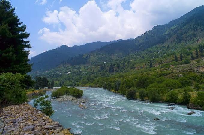
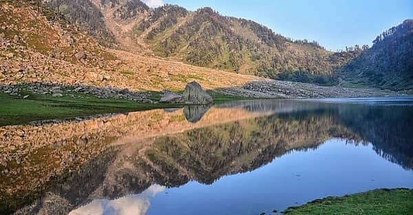
The Indus River is one of Asia’s great rivers and has played an extraordinary role in the history and geography of the Indian subcontinent. Long before modern cities and political boundaries appeared, settlements flourished around the Indus river system. The Indus Valley Civilisation, one of the world’s earliest urban civilisations, developed around this vast drainage network, making the river important not only geographically but historically as well.
Rising in the high Tibetan Plateau near the Lake Manasarovar region, the Indus travels through cold mountain landscapes, deep gorges and broad plains before finally emptying into the Arabian Sea. Its total length is approximately 3,180 km, although figures can differ slightly between geographical sources. Within India, the river is primarily associated with Ladakh, while its wider basin includes several important Himalayan rivers.
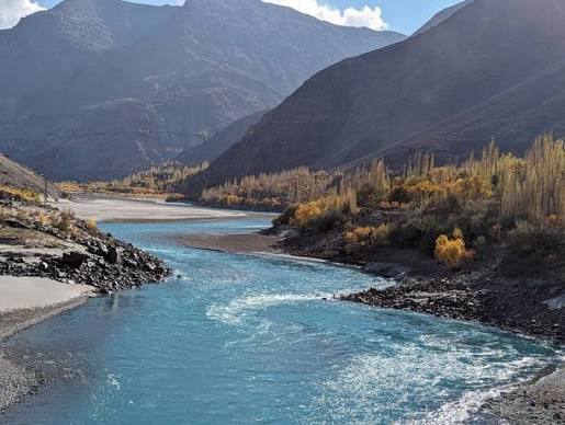
Major tributaries such as the Jhelum, Chenab, Ravi, Beas and Sutlej form a huge river network that has supported agriculture, hydropower, settlements and regional economies for centuries. Understanding the Indus River’s origin, tributaries, length and course is therefore essential for understanding the physical geography of northwestern India.
Indus River Overview
| Particular | Details |
|---|---|
| River Name | Indus River |
| Local/Ancient Name | Sindhu |
| Source Region | Tibetan Plateau |
| Origin Area | Near Lake Manasarovar region, Tibet |
| Approximate Length | About 3,180 km |
| Indian Region Through Which Main River Flows | Ladakh |
| Major Tributaries | Jhelum, Chenab, Ravi, Beas, Sutlej, Zanskar and Shyok |
| Countries Associated with Main Course | China, India and Pakistan |
| Drainage Destination | Arabian Sea |
| River Mouth | Indus Delta in Pakistan |
| Historical Importance | Indus Valley Civilisation |
| International Importance | Indus Waters Treaty |
Where Does the Indus River Originate?
The Indus River originates in the Tibetan Plateau, in the vicinity of the Lake Manasarovar and Mount Kailash region. Its headwaters develop at a very high altitude before the river begins travelling northwest across Tibet.
Known historically in India as the Sindhu, the river is mentioned in ancient Indian traditions and texts. In fact, the names “India” and “Indus” are historically connected with the name Sindhu.
After beginning its journey in Tibet, the river enters the Indian region of Ladakh, where it flows through a spectacular high-altitude landscape.
Important points about the Indus River’s origin:
- It originates on the Tibetan Plateau.
- Its source lies near the Lake Manasarovar–Mount Kailash region.
- The river is known as Sindhu in Indian tradition.
- It enters India through Ladakh.
- It ultimately drains into the Arabian Sea.
What Is the Length of the Indus River?
The Indus River is approximately 3,180 kilometres long, making it one of the longest rivers in Asia.
Different sources may provide somewhat different measurements because identifying the precise beginning of a large river system and measuring every curve of its channel can produce variations.
The Indus travels through three major geographical regions during its long journey:
- Tibetan highlands
- Himalayan and Karakoram mountain regions
- Plains of Pakistan
It finally forms a large delta before reaching the Arabian Sea.
Which Indian States Does the Indus River Flow Through?
The main channel of the Indus River in India flows through the Union Territory of Ladakh.
This distinction is important because the Indus river basin covers a much larger area than the main river itself.
Ladakh
After leaving Tibet, the Indus enters Ladakh and flows generally northwest.
The river passes near important areas such as Leh and receives several Himalayan tributaries along its course.
The landscape surrounding the Indus in Ladakh is dramatically different from the fertile plains normally associated with large rivers. It is a cold, high-altitude desert where the river creates narrow green belts that support settlements and agriculture.
Important tributaries joining the Indus in or around the Ladakh region include:
- Zanskar
- Shyok
- Suru
- Other Himalayan streams
The famous Sangam near Nimmu marks the confluence of the Zanskar and Indus rivers and is one of the best-known geographical attractions near Leh.
Wider Indus Basin in India
Although the main Indus flows through Ladakh, its wider river system extends across parts of north and northwestern India through major tributaries.
The basin is associated with regions including:
- Ladakh
- Jammu and Kashmir
- Himachal Pradesh
- Punjab
- Haryana
- Rajasthan
Therefore, readers should not confuse the route of the main Indus channel with the much larger Indus drainage basin.
Course of the Indus River from Source to Sea
The Indus makes an extraordinary journey from some of the world’s highest terrain to the Arabian Sea.
Upper Course in Tibet
The river begins on the Tibetan Plateau and initially travels through a cold and dry high-altitude landscape.
Several mountain streams contribute water as the river moves westward and northwestward.
Indus in Ladakh
After entering Ladakh, the river flows between major mountain systems.
The Zanskar River joins the Indus near Nimmu. Further downstream, other rivers draining the Karakoram and Himalayan regions contribute to the system.
Snow and glacier melt are particularly important for maintaining river flow in this high-altitude environment.
Course Through Pakistan
After leaving the Indian-administered region, the Indus continues through Pakistan.
As it moves south, several major tributaries eventually contribute water to the main system. The river becomes especially important for irrigation across the plains.
After travelling across Pakistan, it forms the Indus Delta and empties into the Arabian Sea.
Major Tributaries of the Indus River
The Indus has an enormous tributary network. For Indian geography, five rivers of the historic Punjab region are particularly important.
1. Jhelum River
The Jhelum originates at Verinag in Jammu and Kashmir. It flows through the Kashmir Valley, including Srinagar, before continuing westward.
It ultimately joins the Chenab.
2. Chenab River
The Chenab is formed by the confluence of the Chandra and Bhaga rivers in Himachal Pradesh.
It flows through the Himalayan region before entering Jammu and Kashmir and continuing towards Pakistan.
3. Ravi River
The Ravi River originates in the Himalayas of Himachal Pradesh.
It flows through the Chamba region and eventually continues towards Pakistan, where it joins the Chenab.
4. Beas River
The Beas River originates near Beas Kund in Himachal Pradesh.
Unlike the other major Punjab rivers, the Beas remains within India throughout its course and ultimately joins the Sutlej in Punjab.
5. Sutlej River
The Sutlej is one of the longest major tributaries in the Indus system.
It originates in the Tibetan region, enters India through Himachal Pradesh and continues into Punjab before flowing towards Pakistan.
Important Himalayan Tributaries of the Indus
Apart from the five well-known Punjab rivers, several mountain rivers directly contribute to the upper Indus system.
Zanskar River
The Zanskar River is an important tributary in Ladakh. It meets the Indus near Nimmu, creating the famous Indus-Zanskar confluence.
Shyok River
The Shyok River originates from the Karakoram region and flows through northern Ladakh before joining the Indus system.
Its basin is influenced significantly by glaciers and snowmelt.
Suru River
The Suru River drains parts of the Kargil region and forms part of the wider upper Indus drainage network.
Indus River and the Five Rivers of Punjab
The historic Punjab region is closely associated with five major rivers:
- Jhelum
- Chenab
- Ravi
- Beas
- Sutlej
The word Punjab is derived from words meaning “five waters” or “land of five rivers.”
These rivers created fertile plains and supported agriculture and settlements for centuries. Their waters ultimately contribute to the wider Indus drainage system.
Modern international boundaries mean that the geography of these rivers is now shared between India and Pakistan.
Importance of the Indus River
The Indus is important for far more than its impressive length.
Agriculture and Irrigation
The Indus river system supports one of the world’s largest irrigated agricultural regions. Its water is used for crops including:
- Wheat
- Rice
- Cotton
- Sugarcane
- Maize
- Pulses
- Vegetables
Hydroelectric Power
Mountain rivers in the Indus basin provide significant opportunities for hydropower because of their steep gradients and strong flows.
Water Supply
Millions of people across the broader Indus basin depend directly or indirectly on its rivers for freshwater.
Historical Importance
The Indus Valley Civilisation developed around the Indus river system thousands of years ago. Major ancient urban centres were supported by the fertile river plains and associated water resources.
Indus Waters Treaty
The Indus river system is also internationally significant because its waters are shared between India and Pakistan.
The Indus Waters Treaty, signed in 1960, established a framework concerning the use of the six major rivers of the Indus system.
They are broadly classified as:
Eastern Rivers:
- Ravi
- Beas
- Sutlej
Western Rivers:
- Indus
- Jhelum
- Chenab
The treaty contains detailed provisions governing the rights and permitted uses of these waters, making the Indus system a major subject of international water management.
Why Is the Indus River Important to India?
For India, the Indus system has geographical, historical, agricultural and strategic importance.
Key reasons include:
- Ancient heritage: Closely connected with the Indus Valley Civilisation and the historical Sindhu region.
- Himalayan drainage: Drains extensive mountainous areas.
- Agriculture: Tributaries provide vital irrigation water in northwestern India.
- Hydropower: Himalayan rivers support electricity-generation projects.
- Water resources: The river system supports millions of people.
- International importance: Its waters are shared across international borders.
- Cultural significance: The Sindhu holds an important place in Indian history and tradition.
FAQs About the Indus River
1. Where does the Indus River originate and where does it end?
The Indus River originates on the Tibetan Plateau near the Lake Manasarovar–Mount Kailash region. It flows through Tibet, Ladakh and Pakistan before finally emptying into the Arabian Sea through the Indus Delta.
2. What is the total length of the Indus River?
The Indus River is approximately 3,180 km long, although estimates can vary depending on the source and measurement method. It is one of the longest rivers in Asia.
3. Which are the five major rivers associated with the Indus system and Punjab?
The five historic rivers of Punjab are the Jhelum, Chenab, Ravi, Beas and Sutlej. These rivers form an important part of the wider Indus drainage system.
4. Does the main Indus River flow through Punjab in India?
No. The main channel of the Indus River in present-day India flows through Ladakh, not the state of Punjab. Punjab is part of the wider Indus basin and is crossed by important Indus-system rivers such as the Sutlej, Beas and Ravi.